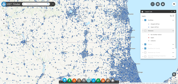
Screenshot of the UST Finder web mapping tool
EPA and states have developed a national web mapping tool and database, UST Finder, to provide users with a first-ever national picture of underground storage tank (UST) facilities, USTs, and leaking UST (LUST) sites and their relationship to populations, potential flooding risks, private domestic wells, and source water protection areas. EPA’s Office of Underground Storage Tanks, Office of Research and Development, and the Association of State & Territorial Solid Waste Management Officials worked together to gather publicly available information in all 50 states and the District of Columbia. The tool can help states prioritize cleanups and assess potential vulnerabilities to human health and the environment.
UST Finder provides the attributes and locations of active and closed USTs, UST facilities, and LUST sites from states as of 2018-20. It is available on EPA’s GeoPlatform and works on mobile phones, tablets, and computers.
A two-page overview of UST Finder is available here. For more information, contact Alex Hall of EPA.