How do environmental managers and public health officials identify the benefits that local forests, parks, wetlands, and other natural areas provide to their local communities? One way is through EPA’s EnviroAtlas. The rich web-based resource system provides users with a host of interactive tools, geospatial data, and resources for exploring the benefits people derive from nature and the potential stressors that might impede this.
EnviroAtlas includes:
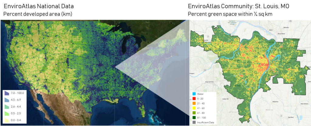
- A GIS-based mapping application built on a robust platform of more than 400 layers of environmental and public health data, with additional fine-scale data for more than 1,400 cities and towns centered on 30 U.S. urbanized community areas
- An easy-to-use Eco-Health Relationship Browser illuminating the links between ecosystems, the services they provide, and their impact on human health and well-being
- Teaching resources and educational modules
- Built-in analysis tools
EnviroAtlas is designed to inform decision-making, education, and research. It provides a one-stop shop for exploring ecosystem services and benefits in the context of planning and management. The resource helps EPA partners in states and local communities enhance public health, environmental resiliency, and economic prosperity.
Learn More!
Interested in learning how to use EnviroAtlas in your own state or community? Please listen to this recently recorded webinar for an overview of EnviroAtlas tools and resources; training on using the Interactive Map and Eco-Health Browser and accessing and downloading data; and examples of real-world data use.
For more information on EnviroAtlas, please contact Anne Neale, Research Scientist and Project Lead in EPA’s Office of Research and Development.